Bike tour: Pulp Friction, Train Robbery, & Capital crimes. Who killed Ottawa's waterfront?s
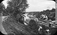
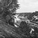
Photo: The Bytown Museum and the canal locks descending to the Ottawa River.
It's easy for modern Ottawa residents to forget that we are a waterfront city. No really. We are! The city exists because of the three great rivers that meet here, and we grew because of the river-based lumber trade and the magnificent human-engineered waterway the Rideau Canal. But it has never been an easy relationship. Between the 19th century exploitation of the waterfront by railways and heavy industry, and the 20th century expropriation of all privately owned land along Ottawa's urban waterfront (for high speed commuter roadways), we've gradually become detached from our waterfront---and our heritage.
Ask yourself the question: can you name one great public space on the Ottawa waterfront? Apart from a couple of isolated restaurants and long narrow strips of "park" space along high-speed roadways, where is our great waterfront square? Our great boardwalk? Our Granville Island? Our Neuhavn like Copenhagen? Our Venetian canal-side Piazza San Marco?
Fortunately, we do have bike paths along the river (thank you, NCC!) so we'll use our bikes to trace the surprisingly drastic changes that 200 years have wrought. Spoiler alert: we'll see a lost beach, several forgotten major tourist attractions, lots of decaying attempts at "urban renewal," not a single play structure for kids, and pavement, pavement, pavement where people should be.
This tour asks the question: after two centuries of allowing industry and governments to divorce us from our rivers and canal, how can the citizens of Ottawa start reclaiming our waterfront spaces as true, lively, and sustainable urban *places*?
The twitter hashtag for this walk is #OttWaterfront